


Col du Chaussy - croix de la Chal

laurentnecca
User
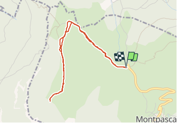

Length
4.8 km

Max alt
1830 m

Uphill gradient
287 m
Km-Effort
8.6 km

Min alt
1534 m

Downhill gradient
290 m
Boucle
Yes
Creation date :
2023-11-08 09:19:38.825
Updated on :
2023-11-08 11:35:58.811
2h02
Difficulty : Easy

FREE GPS app for hiking
 SityTrail
IGN / Geographical institutes
SityTrail Plus
The world is yours!
About
Trail Walking of 4.8 km to be discovered at Auvergne-Rhône-Alpes, Savoy, La Tour-en-Maurienne. This trail is proposed by laurentnecca.
Positioning
Country:
France
Region :
Auvergne-Rhône-Alpes
Department/Province :
Savoy
Municipality :
La Tour-en-Maurienne
Location:
Pontamafrey-Montpascal
Start:(Dec)
Start:(UTM)
292867 ; 5024532 (32T) N.
Comments